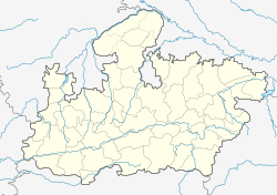
Bhopal
Praèn
| Bhopal भोपाल | |
| "City of Lakes" | |
| — capital and metropolitian area — | |
| Coordinates | 23°15′N 77°25′E / 23.25°N 77.42°ECoordinates: 23°15′N 77°25′E / 23.25°N 77.42°E |
| Country | India |
| State | Madhya Pradesh |
| District(s) | Bhopal |
| Municipal Commissioner | Manish Singh |
| Mayor | Krishna Gaur (BJP) |
| Population • Density |
1,795,648[1] (2011[update]) • 2,575 /km2 (6,669 /sq mi) |
| Time zone | IST (UTC+05:30) |
| Area |
697.24 km2 (269 sq mi) • 427 metres (1,401 ft) |
Bhopal ya iku kutha kang dumunung ana ing sisih tengah India. Sing ndunungi kulawantar kanthi cacah 1.888.000 jiwa (2005). Bhopal uga dadi kutha krajan praja Madhya Pradesh.
Cathetan sikil
[besut | besut sumber]- ↑ Bhopal Population. Census of India. Retrieved 2 May 2011.
| Artikel géografi India iki minangka artikel rintisan. Kowé bisa ngéwangi Wikipédia ngembangaké. |


